Contact Us:
- Centers for Disease Control and Prevention
1600 Clifton Rd
Atlanta, GA 30333 - 800-CDC-INFO
(800-232-4636)
TTY: (888) 232-6348
24 Hours/Every Day - cdcinfo@cdc.gov
Public Health Assessment
Drinking Water Supplies and Groundwater Pathway Evaluation,
Isla de Vieques Bombing Range,
Vieques, Puerto Rico
To print this report, please select the "Print Friendly View" option in left hand menu and use your browsers print function or the "Print Page" option on the right side of the page. You may also print individual sections of the report by navigating to a section using the left hand menu and following the same steps above.
October 16, 2001
Prepared by:
Federal Facilities Assessment Branch
Division of Health Assessment and Consultation
Agency for Toxic Substances and Disease Registry
II. Background
Vieques is approximately seven miles southeast of the main island of Puerto Rico (Figure 1). It is the largest offshore island that is part of the Commonwealth of Puerto Rico--20 miles long, 4.5 miles at its widest point, and about 33,088 acres in area (51 square miles). Vieques has low rounded hills and small valleys, with an east-west ridge near the center. The average elevation is about 246 feet above mean sea level. The highest point is Monte Pirata (987 feet above mean sea level), which is located in the southwest corner. There are no permanent streams (i.e., no surface water drinking supplies) on the island; however, after rainfall, temporary streams flow for a few days (Cherry and Ramos 1995).
Land Use:
Historically, sugarcane was grown throughout the island and milled in Centrales (Torres-Gonzalez 1989). The sugarcane industry caused a peak in Vieques' economic growth in the late 19th century, however, sugarcane is no longer commercially grown on the island. The Navy bought much of the island in the 1940s, after the decline suffered by the sugar cane industry. The Navy used the eastern third and western third of Vieques until 2001, when the western third of the island was released to la Isla de Vieques, the Puerto Rico Conservation Trust, and the U.S. Department of the Interior. Manufacturing became more important for the economy in the 1960s and 1970s, especially with the construction of the General Electric Plant in 1969 (Bermudez 1998). Currently, there is minimal manufacturing on the island.
Currently, the land is used mostly for cattle pasture land, minor agriculture, and urban development. In the past, sugarcane was the principle crop on the island. Other crops have included coconut, grains, sweet potatoes, avocados, bananas, and papayas. Commercial fishing is operated out of both Esperanza and Isabel Segunda. More recently, tourism has been increasing in economic importance. Small restaurants and hotels have been opened in the cities.
Demographics:
ATSDR examines demographic information (i.e., population information) to identify the presence of sensitive populations, such as women of childbearing age (ages 15 to 44), young children (age 6 and under), and the elderly (age 65 and over). Demographics also provide details on residential history in a particular area--information that helps ATSDR assess time frames of potential human exposure to contaminants.
The 2000 U.S. Census Bureau reported that 9,106 people live on Vieques. This figure includes residents on both the residential lands and Navy property. Three potentially sensitive populations were identified: women of childbearing age, children, and the elderly. About 19% (1,701 residents) of the population consists of women of childbearing age. Children account for 11% (1,001 residents) of the population and 14% (1,263 residents) of the population is elderly. According to several anecdotal accounts, the population of Vieques is not highly mobile; many are lifelong residents of the island.
Most of the residents of Vieques live in the two largest towns on the island, Isabel Segunda and Esperanza. Although these towns are located relatively close to the Navy property, they are several miles removed from the LIA. Specifically, the nearest point on residential lands to the geographic center of the LIA is approximately 7.9 miles (12.7 kilometers). Therefore, before any contaminants from the LIA can reach the residential populations of Vieques, they would have to travel over a distance of at least 7.9 miles.
Geology:
Vieques was formed from igneous and volcanic rock, mostly granodiorite, quartz diorite, and some lavas which created the bedrock of the island. This bedrock is exposed and weathered on most of the western half of the island and on the central portion of the eastern half of the island. Because of the weathering of the bedrock, gravel and sands wash downhill during storms. Over the years this material has gathered in valleys by the ocean, forming alluvial deposits (sediment deposited by flowing water) where the valley meets the sea. The alluvial sedimentary deposits generally consist of a mixture of gravel, sand, silt, and clay. Other portions of Vieques have ancient marine deposits from a time when the island was submerged, revealing areas with some limestone, sandstone, siltstone, and other sedimentary rocks at the surface.
Hydrogeology:
All the groundwater on Vieques is derived from rain that falls on the island. This water runs downhill as intermittent stream runoff or it seeps into the soil and underlying deposits. Water in pore space, cracks, and fractures in the weathered bedrock eventually flows to the ocean or into alluvial deposits.
The first type is within the upper portion of the bedrock and sedimentary rocks. The weathering, fracturing, and faulting of this rock has created pore space, joints, or fractures where water can seep underground. The flow of groundwater in these unnamed aquifer systems is controlled by the influence of gravity and flows in a downhill direction through the pore space and along fracture or joint surfaces. Although groundwater flow may be locally obstructed in areas where dense, nonporous rock or fault surfaces block the downhill flow, the groundwater cannot flow through the bedrock in an east-west direction from one side of the island to another. This fact was confirmed in a groundwater study that examined monitoring wells installed across the center of the island from north to south along the boundary of the Eastern Maneuver Area (EMA) [CH2MHILL and Baker 1999].
The second type of aquifer is within the alluvial deposits where water seeps into the sand and gravel areas, filling up the pore space between these materials. These alluvial aquifers are found below the hills in the low flat valleys along the coast (Figure 2). Water flow within these aquifers is also downhill and generally towards the sea in most cases. The alluvial aquifers are self-contained; water cannot flow from one alluvial aquifer to another on the island.
Within Esperanza valley, the largest alluvial valley in Vieques, is the primary aquifer on the island. The alluvial deposits extend from the vicinity of Ensenada Sombre in the residential area to Bahia Tapon in Camp Garcia. The United States Geological Survey (USGS) studied the Esperanza valley in 1989 and reported that groundwater flow in the alluvial deposits of Esperanza valley was toward the south and the sea. Other aquifers studied by USGS include: the Resolucion valley aquifer, the Playa Grande aquifer, and the Camp Garcia aquifer (Figure 2). Small unnamed alluvial deposits exist around the island, and they may contain groundwater, but they have not been used or studied.
Esperanza valley is located in the south-central area of the island. The area of the valley is about 10 square miles and the alluvial deposits are about 60 feet thick. The water table ranges from 10 to 100 feet above mean sea level. Transmissivity values (the rate of groundwater flow through a certain thickness) have been reported as ranging from 200 square feet (ft2)/day near Camp Garcia to as much as 2,000 ft2/day east of Ensenada Sombre. The hydraulic conductivity (the rate of groundwater flow) of the valley increases toward the coast where the amount of sand in the deposits increases. Hydraulic conductivity values for the valley have been estimated as less than 1 ft/day along the north-central hills in the valley to as much as 35 ft/day near the coast. Rainfall is the primary source of recharge to the aquifer; with the rainy season usually from August to November. Recharge is limited by the low permeability of limestone located along the south-central shoreline and by a 5-foot thick clay layer that exists near the top of the aquifer at a depth of 25 feet or less.
Within Resolucion valley is an 8-square mile aquifer located in the northwestern section of Vieques. The alluvial deposits average about 30 feet thick and overlie the bedrock (granodiorite and quartz diorite). This valley also has a semi-confining clay layer at about 20 to 30 feet below ground surface. Because of its location next to Monte Pirata, the highest point on the island, this aquifer typically receives more rainfall recharge than the others.
Climate:
Vieques climate is tropical-marine with temperatures that average about 79 degrees Fahrenheit. Annually, the temperature ranges from an average of 76 degrees Fahrenheit in February to 82 degrees Fahrenheit in August. Vieques lies in the path of the easterly trade winds, which regulate the rainfall on the island. The average amount of precipitation is about 45 inches a year. The western part of the island receives a higher amount of rainfall (about 50 inches a year) than the eastern section (about 25 inches a year). The rainy season is from August through November while the remainder of the year is drier. Tropical storms are common from June to November (NCDC 1985-1994; Torres-Gonzalez 1989).
In the summer, Vieques receives an increase of airborne dust particles through the natural occurrence of African dust storms. Each year, large quantities of dust from the Sahara Desert in Africa are transported at high altitudes to the Caribbean Sea and southeastern United States. The African dust can include soil fungus (e.g., Aspergillus), chemicals (e.g., iron, phosphorous, and sulfates), or even insects (e.g., African desert locusts) [USGS 2000].
Navy Operational History:
The Navy has occupied portions of Vieques since 1941, when 10,362 people lived on the island (Bermudez 1998). The Navy facilities are under the command of the Roosevelt Roads Naval Station on the mainland of Puerto Rico. In 1960, the Navy established targets on Vieques and, in 1971, began training exercises on the eastern part of the island. EMA is located to the east of the residential land and is used for training by Marine amphibious units, battalion landing teams, and combat engineering units. Camp Garcia is located within the southern section of EMA. Further east, the Atlantic Fleet Weapons Training Facility (AFWTF) is used for naval gunfire support and air-to-ground ordnance delivery training (CH2MHILL and Baker 1999). At the eastern end of the island, within AFWTF and to the west of the Punta Este Conservation Zone, is the LIA, where live bombing occurred. Recently, however, the Navy and the Commonwealth of Puerto Rico agreed that only nonexplosive bombs (including inert and practice bombs), instead of live munitions, would be used. Prior to May 2001, the Navy owned 8,200 acres on the western third of the island for the Naval Ammunition Support Detachment (NASD). Most of the NASD lands are undeveloped and were used for limited Navy operations, mainly storage. In May 2001, the Navy transferred most of the NASD to la Isla de Vieques, the Puerto Rico Conservation Trust, and the U.S. Department of the Interior. The Navy retained about 1% of the former NASD lands for a communication facility (Navy 2001a).
The LIA has, until 1999, been used for live ammunition training from off-shore ships, airplanes, and land-based personnel. The major exercises usually occur in the spring and fall with smaller activities conducted throughout the year (IT 2000). Within the LIA an Open Burning/Open Detonation (OB/OD) area is used to treat unexploded ordnance (UXO; i.e., bombs or explosive projectiles that did not explode) and to detonate waste military munitions. The UXO are taken to the authorized area and detonated with a remote control charge. If UXO cannot safely be transported to the OB/OD area, it is detonated on site in accordance with all existing requirements.
The first kind of explosive is made from organic nitrated compounds (i.e., only carbon, hydrogen, oxygen, and nitrogen). Carbon dioxide (35%), nitrogen (27%), and carbon monoxide (16%; which rapidly oxidizes to carbon dioxide) are the primary byproducts that result from an explosion from this type of bomb. Water (8%), ethane (5%), carbon (6%), and propane (2%) are other minor byproducts. Trace amounts (less than 1%) of ammonia, hydrogen, hydrogen cyanide, methane, methyl alcohol, and formaldehyde are also formed.
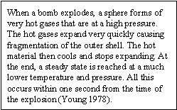
The second kind of explosive contains aluminum. The byproducts from a bomb made with this type of material includes all the chemicals listed for the first kind as well as acetylene, ethylene, phosphine, and aluminum oxide. The primary byproducts are aluminum oxide (38%), carbon monoxide (24%; which rapidly oxidizes to carbon dioxide), nitrogen (18%), and carbon (13%). Ethane (3%), water (1%), and hydrogen (1%) are formed to a lesser degree. Less than 1% of the remaining byproducts (i.e., carbon dioxide, ammonia, propane, hydrogen cyanide, methane, methyl alcohol, formaldehyde, acetylene, ethylene, and phosphine) are formed (Young 1978).
Historically, during typical naval gunfire support training, 82% of the bombs used have been nonexplosive bombs and 18% were live bombs. During typical air to ground ordnance delivery training, 85% of the bombs used were nonexplosive bombs and 15% were live bombs (Navy 1990). Generally, bombing activities are the greatest in February and August with fewer maneuvers in April, May, November, and December.
A recent event that resulted in community concern was the inadvertent use of depleted uranium (DU) ammunition during a February 19, 1999 training exercise (NRC 2000). On that date two U.S. Marine Corps aircraft fired 263 rounds of ammunition armed with DU penetrator projectiles on the LIA. The use of DU ammunition rounds on the LIA is not authorized under the permit issued by the Nuclear Regulatory Commission (NRC). Navy personnel reported the incident to the Environmental Quality Board in person as soon as notification was received from the U.S. Marine Corps.
The NRC was notified by the Naval Radiation Safety Committee (NRSC) on March 5, 1999 and between March 10 and 19, 1999 a team of Navy health physics personnel were sent to the LIA. That team successfully recovered the equivalent of 57 complete DU penetrators. The Navy has committed to recover all detectable DU penetrators from the LIA and has reportedly as of September 2001, recovered 116 equivalent units. Removal of the remaining units will be accomplished during range refurbishment as the units are exposed over time. The remaining units are in locations where UXO is a concern. The NRC continues to monitor the Navy's efforts to recover the remaining DU rounds (NRC 2000).
From June 6 to 15, 2000 the NRC conducted an inspection of Vieques including the LIA, the EMA, the central residential sector of the island, and the NASD area. That inspection was for the purpose of collecting direct radiation measurements and environmental samples, for subsequent analysis, to evaluate if the DU rounds fired by aircraft on the LIA may have contaminated the environment and, in turn, may result in a potential source of radiation exposure for Vieques residents. Sampling locations were selected based upon a predetermined grid. A total of 84 soil, 17 vegetation, seven surface water, and six sediment samples were collected.
The results of the NRC investigation were released on September 28, 2000 and disclose that the only detections of uranium, at levels above the natural background level, were measured in five samples collected in the holes where DU rounds were found. The NRC concluded that there was no spread of DU to areas outside the LIA and that the public outside the LIA has not been exposed to DU contamination or radiation above normal background levels (NRC 2000). Further, the NRC concluded that Vieques inhabitants could have only received a measurable dose of radiation from the DU firing event if they had direct access to a DU penetrator for an extended period of time (NRC 2000).
ATSDR has reviewed the findings of the NRC report and concludes that the levels of radiation detected on Vieques do not represent a public health hazard. This DU ammunition firing event does not represent a potential source of groundwater or drinking water contamination. For this reason, this potential source of contamination will not be discussed further in this PHA.
Quality Assurance and Quality Control:
In preparing this PHA, ATSDR reviewed and evaluated information provided in the referenced documents. The environmental data presented in this PHA are from reports produced by the Navy, Puerto Rico Department of Health (DOH), USGS, NRC, and the United States Environmental Protection Agency (EPA).The limitations of these data have been identified in the associated reports.The sampling procedures, analytical methods, and detection limits established for those investigations were consistent with the objectives of those investigations. Based on our evaluation, ATSDR determined that the quality of environmental data available in the site-related documents for Vieques is adequate to make public health decisions.
![]()
